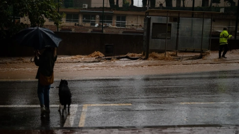
Most of the Peninsula will face this weekend with clear or partly cloudy skies, although the State Meteorological Agency (AEMET) warns that the peninsular Mediterranean area and the Balearic Islands will experience locally strong showers, while temperatures will begin to drop progressively, a trend that, according to the agency's spokesperson, Rubén del Campo, will intensify in the following days
.
Del Campo detailed that this Saturday there will be rains in areas bathed by the Mediterranean Sea, more intense in the provinces of Valencia and Alicante, as well as showers in the Balearic Islands. In both cases, AEMET warns that these precipitations could be locally strong and persistent. In the rest of the Peninsula, however, partly cloudy skies and temperatures without major changes are expected, although somewhat lower than in previous days in the eastern Peninsula.
Sunday and Monday: drop in temperatures and first frosts
On Sunday, the first day of November, the situation will be similar, with partly cloudy or clear skies in most of the Peninsula and new showers in the Mediterranean area, especially at dawn, which will diminish throughout the day. Rubén del Campo specified that temperatures will be lower and that the night will be cool in the northern plateau.
On Monday, it will rain in areas of Catalonia and the Valencian Community, especially in coastal areas, without ruling out precipitation in the Region of Murcia or the Balearic Islands. Temperatures will continue to drop, with some frosts in mountain areas and the northern plateau, while in the south of Seville temperatures could still reach 30 degrees, Madrid will not exceed 18 degrees, and Pamplona will stay around 13 or 14 degrees, according to AEMET's forecast.
Predicción del puente de Todos los Santos (actiualización): 🌞Predominio de sol en gran parte de la península. 🌧️ Viernes y sábado, en Baleares, chubascos algunos con tormenta y de fuerte intensidad; en el litoral levantino chubascos ocasionales. https://t.co/kMniUIkbQv
— AEMET (@AEMET_Esp) October 30, 2026
A small DANA will increase instability from Tuesday
From Tuesday, meteorological uncertainty will increase significantly with the arrival of a small DANA in the area of the northern peninsula. The AEMET spokesperson explained that it is difficult to pinpoint its location and trajectory, although it will probably cause an increase in atmospheric instability, with an intensification of rainfall on Tuesday on the peninsular Mediterranean coast and in the Balearic Islands.
These rains could be locally strong on Tuesday and Wednesday, a day on which precipitation may extend to wide areas of the east, center, and north of the Peninsula. In addition, snowfalls are not ruled out in high mountain areas. Temperatures will drop even further, with cool weather in the north and nocturnal frosts, while in the south, temperatures will still exceed 20 degrees.
Canary Islands: rain, storms, and very strong wind gusts
In the Canary Islands, the weekend will present somewhat unsettled weather. This Friday there will be some weak rains on the most mountainous islands, which will repeat on Saturday and may appear in the form of showers and accompanied by isolated storms. On Sunday, instability will be greater, with locally strong rains, showers, and storms, while the wind will blow with very strong gusts in high areas. This situation will continue on Monday and, to a lesser extent, on Tuesday.
Temperatures will drop on Sunday and then barely vary, with minimums between 20 and 22 degrees and maximums between 25 and 27 degrees in coastal areas.
The November forecast points to an uneven month
For the week of November 2 to 8, AEMET forecasts temperatures probably warmer than normal in the southern peninsula and the Canary Islands, while in the north and the Balearic Islands, values will be more typical for the season, with colder weather and even nocturnal frosts in inland areas. The most abundant precipitation will be concentrated in the peninsular Mediterranean area and the Balearic Islands, while there will also be showers in the Canary Islands. In contrast, in the far north of the peninsula, rainfall will be scarcer than usual for these dates.
Semana del 2 al 8 de noviembre: temperaturas superiores a las normales en la mitad sur peninsular y Canarias; en torno a lo normal en el resto. Lluvias en zonas del este y sur peninsulares y en los archipiélagos. Predicción para las próximas 3 semanas👉 https://t.co/GakBF2JfzV
— AEMET (@AEMET_Esp) October 30, 2026
For the week of November 9 to 15, the state agency indicates that uncertainty increases, although it is most likely to be a period with temperatures above normal for the time of year. Precipitation would affect a large part of the Peninsula, especially the western half, and the Canary Islands, although the forecast could vary considerably in future updates.
The week of November 16 to 22 presents even greater uncertainty, although in principle temperatures would remain above usual values. AEMET does not see a clear trend regarding precipitation, although it could continue to occur in the western peninsula.
